History of Carova Beach
From Spanish explorers to hunting clubs to wild horse sanctuary—the story of North Carolina's last frontier.
A Place Apart
Carova Beach isn't just remote—it's deliberately unconnected. There are no paved roads leading here, and that's by design. This strip of barrier island has resisted development in ways that make it unique on the entire East Coast. Understanding its history helps explain why Carova remains the wild, unspoiled place it is today.
The story begins not in recent decades, but nearly 500 years ago, with Spanish ships sailing along these shores.
Spanish Origins: The First Horses (1520s)
Long before English colonists arrived at Roanoke Island, Spanish explorers were probing the Carolina coast. In 1526, Lucas Vasquez de Ayllon attempted to establish a colony somewhere along the present-day Carolina shoreline. The expedition failed, but the horses they brought—estimated at 80 to 100 Colonial Spanish mustangs—were left behind.
Other Spanish expeditions followed throughout the 1500s, and each left its mark. Ships wrecked on the treacherous shoals. Failed settlements were abandoned. Horses swam to shore or were deliberately released when expeditions met disaster. By the mid-1600s, Spanish breeding ranches existed along the southeast coast, and political instability among English, Spanish, and Native American groups sent even more horses into the wild.
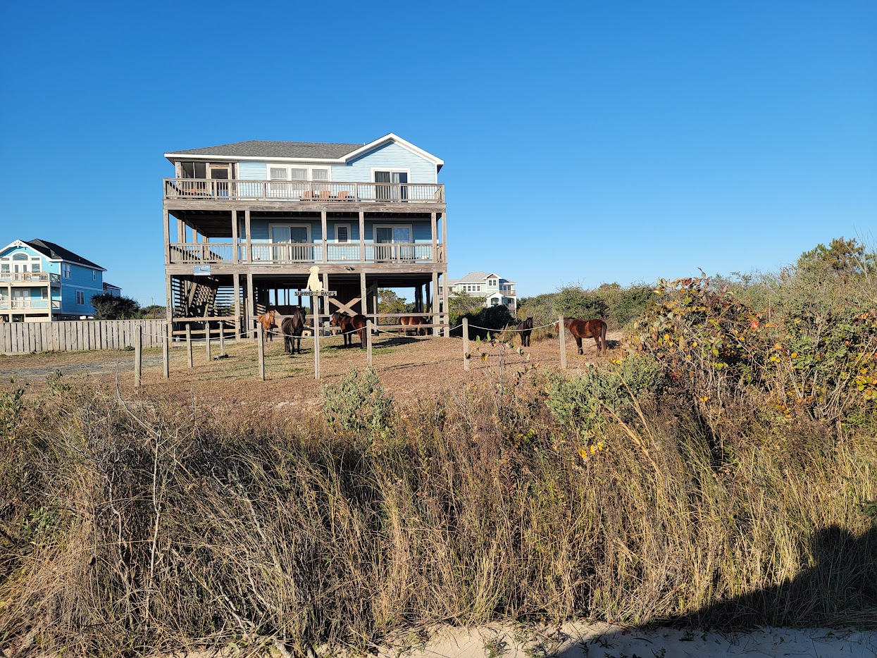
These horses didn't just survive—they thrived. The barrier islands, with their harsh conditions and limited food, actually became a kind of genetic preserve. While Spanish mustangs on the mainland crossbred with other horses over the centuries, the Outer Banks herds remained isolated. DNA testing has confirmed what locals always suspected: the Corolla horses are among the purest descendants of 16th-century Spanish stock remaining in North America.
A Genetic Time Capsule
The Spanish Mustang Registry considers the Corolla herd "as lineally pure to the 16th century Spanish importations as can be found in North America today." Unlike the mustangs of the American West, which have crossbred extensively, these horses are a direct genetic link to the horses of the conquistadors.
By 1926, National Geographic reported 5,000 to 6,000 wild horses roaming the Outer Banks. They were everywhere—from Ocracoke to the Virginia line. Residents lived alongside them as a simple fact of coastal life.
The Hunting Club Era (1857-1930s)
By the mid-1800s, word had spread north about Currituck Sound. The waters teemed with waterfowl—ducks, geese, and swans in numbers that seemed inexhaustible. For wealthy sportsmen from New York, Philadelphia, and Baltimore, this remote stretch of Carolina coast became an irresistible destination.
The Currituck Shooting Club
In 1857, a group of northern sportsmen led by New York City attorney Philo T. Ruggles purchased 3,100 acres of land for just $1 per acre. They incorporated the Currituck Shooting Club—the second hunting club incorporated in the United States and the first in North Carolina.
The club's membership roster read like a who's who of Gilded Age wealth: J.P. Morgan, W.K. Vanderbilt, Andrew Carnegie, and even President Theodore Roosevelt all hunted these marshes. Members arrived by boat across Currituck Sound—there was no other way to reach the club. The original clubhouse was damaged during the Civil War but rebuilt in 1879-1882 as a grand complex of three connected structures.
The Currituck Shooting Club would remain active for nearly 150 years, the oldest club of its kind in America, until fire destroyed the historic clubhouse on March 20, 2003.
The Whalehead Club
By the 1920s, hunting clubs dotted the Currituck Banks—as many as ten shooting clubs operated in the area. But none matched the ambition of Edward Collings Knight Jr. and his wife, Marie Louise Lebel.
Knight was a railway tycoon who already owned luxury homes in Philadelphia and Newport, Rhode Island. But he wanted something more: a private hunting retreat on the Outer Banks. There was just one problem—his wife, a fierce feminist, was determined to hunt alongside him, and the existing clubs permitted men only.
So the Knights built their own. Between 1922 and 1925, they constructed a 21,000-square-foot Art Nouveau mansion on a four-square-mile tract stretching from ocean to sound. They called it Corolla Island. It was wildly out of place—more suited to Long Island's Gold Coast than this backwater stretch of North Carolina. The house had a basement (a first for the Outer Banks) and electricity, which wouldn't reach the wider area until the 1950s.
The Knights died within weeks of each other in 1936. New owners renamed the property the Whalehead Club in 1939. Over the following decades it served as a boys' summer school, a Coast Guard training station during World War II, and even a rocket fuel testing facility. The building fell into disrepair until Currituck County purchased and restored it in the 1990s. Today it's open for tours as part of Historic Corolla Park.
Life on the Banks: Small Communities
While wealthy sportsmen came for seasonal hunting, a small permanent population scratched out a living on these barrier islands. Fishermen, farmers, and the crews of the U.S. Life-Saving Service (predecessor to the Coast Guard) made their homes in tiny communities scattered along the coast.
The Lost Village of Seagull
About 15 miles north of Corolla, nestled at the base of Penny's Hill, once stood a village called Seagull. At its peak, roughly 120 people lived there. It had a Life-Saving Station, a one-room schoolhouse, and a post office. The village sat along the banks of New Currituck Inlet.
Then Penny's Hill began to move. The massive sand dune, the second largest in North Carolina after Jockey's Ridge, migrated inexorably southward, pushed by coastal winds. It filled in the inlet and swallowed the village whole. Today, Seagull is completely buried—a ghost town beneath the sand.
Penny's Hill
The dune that buried Seagull remains a landmark today, visible from the mainland four miles across Currituck Sound. Life-saving stations once operated at Penny's Hill, and a small community existed there until the devastating Ash Wednesday Storm of 1962 wrecked much of the coastline.
Today, Penny's Hill is a neighborhood in the 4x4 area, located about 2.5 miles north of the beach access ramp. The dune itself is considered a "living dune"—constantly being reshaped by coastal winds, with minimal vegetation holding it in place.
The End of the Earth (1950s-1984)
While roads were being paved throughout most of the Outer Banks in the 1950s and early 1960s, Corolla remained cut off. As late as 1975, only about 15 people lived in the village year-round.
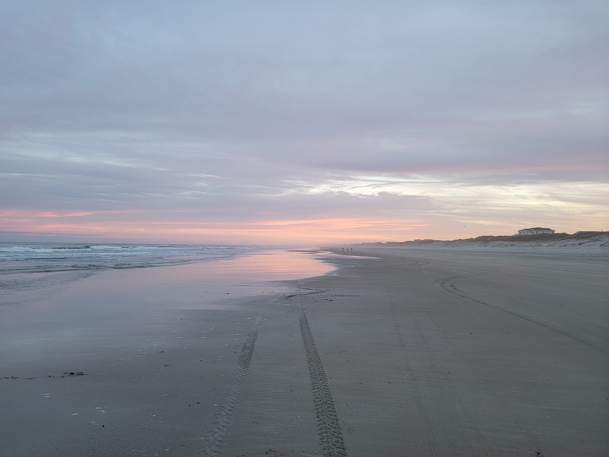
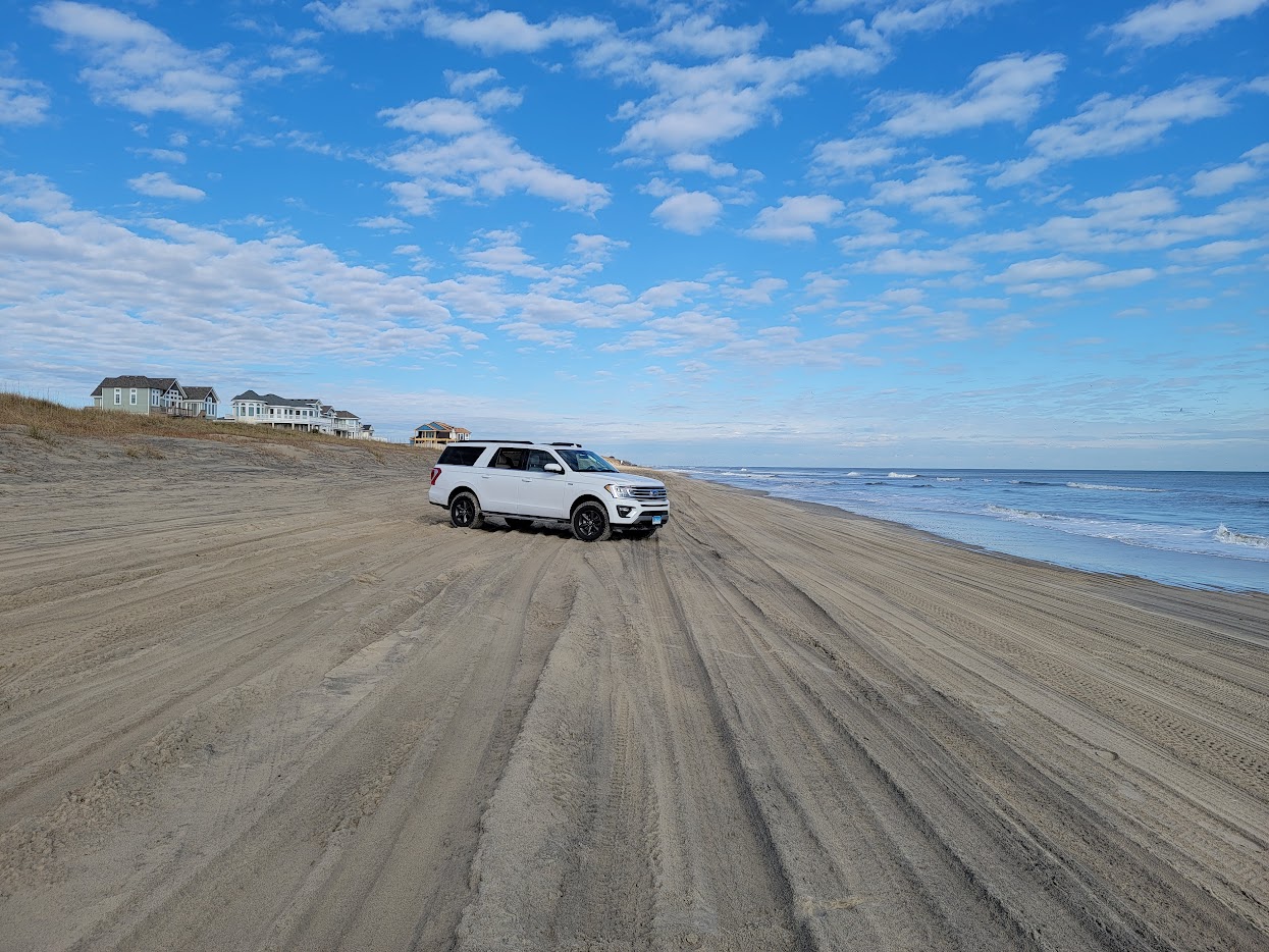
People who visited or lived there describe Corolla as feeling like "the absolute end of the earth." The only access was by boat across Currituck Sound or by driving on the beach from the south—a grueling trip through deep sand, passable only at low tide. What passed for a road was an unpaved track along the soundside, riddled with "truck-swallowing holes" and sugar-fine sand that could trap even experienced drivers.
The Gates Go Up
In 1974, U.S. Fish and Wildlife blocked the Virginia border to prevent excessive traffic through Back Bay National Wildlife Refuge. A gate went up, and only Corolla residents with special passes could cross. That gate remains closed today—you can walk into Virginia, but you cannot drive.
Then, in 1975, developers changed everything. They had been buying up land on the Currituck Banks, building Ocean Sands, Whalehead, and other developments. To protect their private roads, they constructed a guard gate at the southern end of the road into Corolla.
The guard was under strict orders: let no one pass except property owners. For longtime Corolla residents who had lived there for generations, this was infuriating. They found themselves locked out of their own community, dependent on the whims of developers for access to their homes.
The Road Finally Arrives
For nearly a decade, Corolla residents fought for public road access. Finally, in October 1984, the southern guard gate came down. The state took over the road and made it part of NC Highway 12. Paving extended north through Corolla village by 1985.
The road changed everything—and nothing. Development boomed in Corolla, transforming it from an isolated village into a resort destination. But critically, the road stopped at Corolla's northern border. The 4x4 beaches would remain unpaved.
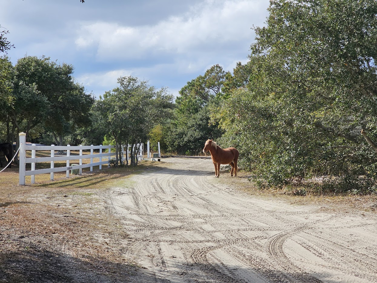
The Horse Crisis and the Fence (1985-1995)
The paved road brought tourists, but it also brought tragedy. Wild horses, accustomed to wandering freely across the entire northern Outer Banks, now had to contend with traffic on NC Highway 12.
Between 1985 and 1995, twenty wild horses were killed by vehicles traveling along the highway. The ancient herd that had survived hurricanes, nor'easters, and centuries of isolation was being decimated by cars.
The Corolla Wild Horse Fund
In 1989, concerned local residents formed the Corolla Wild Horse Fund. Their mission was urgent and specific: build a fence to separate the horses from traffic, and relocate the remaining animals to safety.
The plan was controversial. Moving horses that had roamed freely for centuries felt wrong to some. But the alternative—watching the herd die one horse at a time on the highway—was worse.
In 1995, the Fund completed its mission. They constructed two "sound-to-sea" fences: one at the northern border of Corolla where the pavement ends, and another at the Virginia state line. The roughly 20 horses that had become habituated to the developed areas of Corolla were moved north to join the wild horses already living on the 4x4 beaches.
The result: a 7,544-acre sanctuary spanning the 11 miles from the Corolla fence to the Virginia border. The horses had lost their freedom to roam the entire Outer Banks, but they had gained protection from the cars that were killing them.
Why the Road Stopped
The decision not to extend NC Highway 12 past Corolla wasn't accidental. In the mid-1980s, two wildlife refuges were established: the Currituck National Wildlife Refuge and the Currituck Banks Coastal Estuarine Reserve. These designations made it effectively impossible to pave a road through to Virginia. Combined with community opposition and the challenges of building on shifting barrier island sand, Carova's isolation was preserved—this time by design.
Timeline
Spanish Arrival
Lucas Vasquez de Ayllon's failed colony leaves 80-100 Colonial Spanish mustangs on the Carolina coast. Subsequent Spanish expeditions and shipwrecks add to the wild horse population.
Currituck Shooting Club Founded
New York attorney Philo T. Ruggles leads a group of wealthy sportsmen to purchase 3,100 acres for $1/acre. The club hosts J.P. Morgan, Carnegie, Vanderbilt, and Theodore Roosevelt over its 150-year history.
Whalehead Club Built
Railway tycoon Edward Knight Jr. and his wife Marie Louise construct a 21,000 sq. ft. Art Nouveau mansion—the most elaborate private home ever built on the Outer Banks.
Peak Horse Population
National Geographic reports 5,000-6,000 wild horses roaming the Outer Banks. The herds range freely from Ocracoke to the Virginia border.
Ash Wednesday Storm
The devastating nor'easter wrecks the Outer Banks coastline, destroying much of the small Penny's Hill community and reshaping the barrier islands.
Virginia Border Closes
U.S. Fish and Wildlife installs a gate at the Virginia border to protect Back Bay National Wildlife Refuge. The gate remains closed to vehicles today.
The Developer's Gate
Private developers install a guard gate blocking access to Corolla from the south. Only property owners can pass, effectively trapping longtime residents.
The Road Arrives
The southern guard gate comes down. NC Highway 12 is paved through Corolla, but the decision is made not to extend it further north. The 4x4 beaches remain unpaved.
The Horse Crisis
Twenty wild horses are killed by vehicles on NC Highway 12. The Corolla Wild Horse Fund forms in 1989 to address the crisis.
The Fence Goes Up
Sound-to-sea fences are built at the Corolla border and Virginia line, creating a 7,544-acre sanctuary. Remaining horses are relocated to the 4x4 beaches.
Currituck Shooting Club Burns
Fire destroys the historic clubhouse, ending 146 years of continuous operation as the oldest active hunting club of its kind in America.
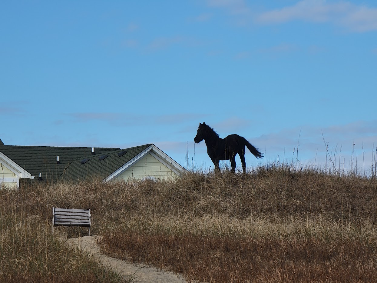
Preserved Wilderness
Approximately 100 wild horses roam the 4x4 beaches. Carova remains one of the last places on the East Coast where Spanish mustang descendants live wild and free.
The Name "Carova"
Carova is a portmanteau combining "Carolina" and "Virginia." The community sits at the northern tip of North Carolina's Outer Banks, just south of the Virginia border. The name reflects its geographic position as a transitional zone between the two states.
Some locals also refer to the area as the "4x4 beaches" or simply "north of Corolla." Whatever you call it, the meaning is the same: this is the end of the road, where the pavement stops and the adventure begins.
Learn More
Dive deeper into Carova's history and the story of the Outer Banks wild horses through these resources:
Museums & Historic Sites
Historical Photo Archives
The Aycock Brown Photograph Collection at the NC Digital Collections contains hundreds of images of Outer Banks beach life from the 1940s and 1950s. Brown's photographs documented the transformation of the Outer Banks from isolated fishing villages to tourist destinations.
The Outer Banks History Center in Manteo maintains extensive archives of historical photographs showing beach driving and coastal life dating back to the early 1900s. Their collections include images from the Life-Saving Service era, the hunting club period, and the development boom of the 1980s. Visit in person or browse their Flickr collection.